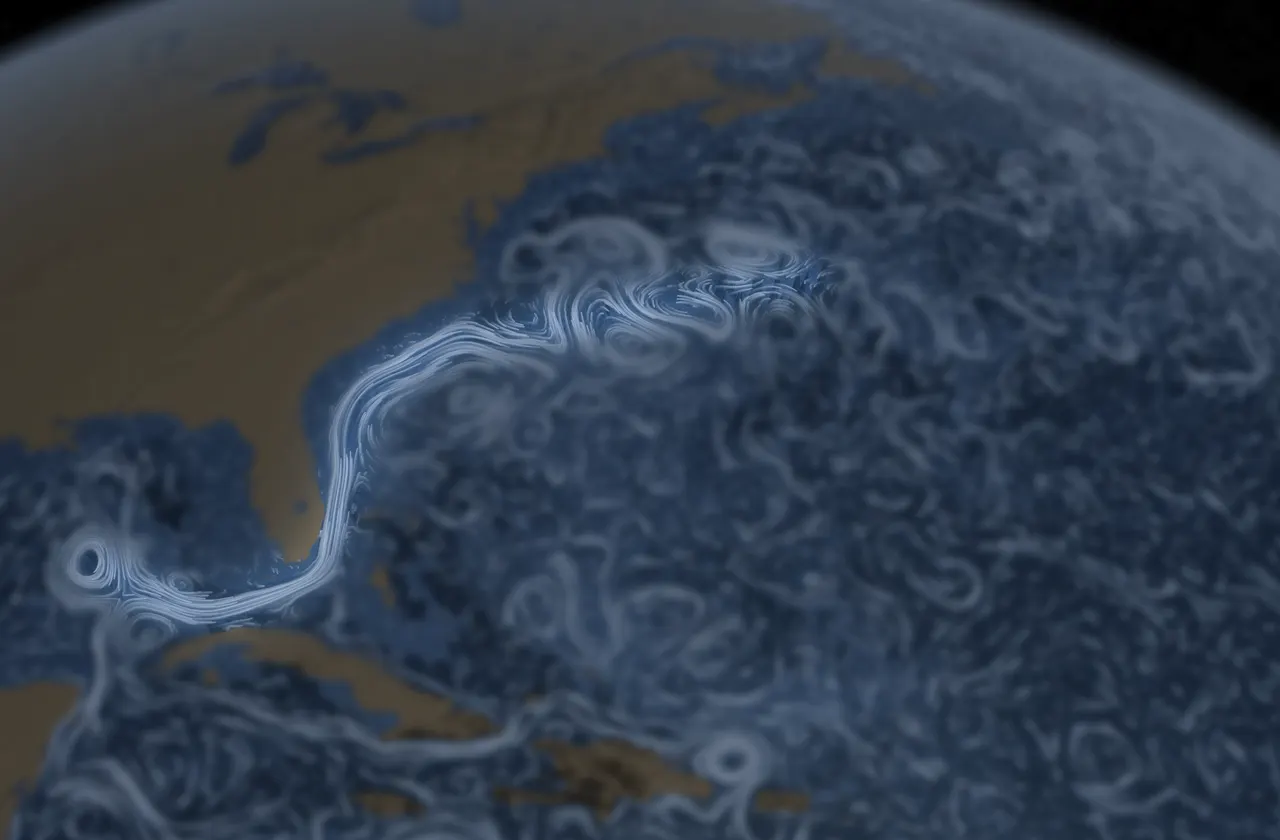

There is a river in the sea. Between Florida and the Bahamas it narrows into the Florida Current, warm and deep blue, and runs north along the coast before turning east into the open Atlantic.
There is a river in the ocean: in the severest droughts it never fails, and in the mightiest floods it never overflows; its banks and its bottom are of cold water, while its current is of warm… There is in the world no other such majestic flow of waters.
Its scale is hard to picture. Through the Straits of Florida it carries about 30 million cubic meters of water every second, or about 30 sverdrups. That is roughly 25 times the flow of all the world’s rivers combined. At the surface it can run at about 4 to 5.6 miles per hour, among the fastest currents in the ocean.
It has no single beginning or end. The Gulf Stream is the western edge of the North Atlantic subtropical gyre, a great clockwise circulation. Past Cape Hatteras it leaves the coast and carries warm water across the ocean as the North Atlantic Current, toward Europe, before the circle turns south and west again.
Sailors learned its ways long before scientists measured it. Ponce de León’s ships met it in 1513, and Spanish fleets later rode it home from the Americas. Spanish pilots’ knowledge of the current was not widely shared. Around 1769–1770 Benjamin Franklin and his cousin Timothy Folger, a Nantucket captain, printed one of the first charts of the stream so mariners could use it or avoid it.
We took our name from it: a quiet, constant current beneath the changing surface. It is a still point that carries everything forward.
Sources
- Matthew Fontaine Maury, The Physical Geography of the Sea (New York: Harper, 1855), ch. 2, §70. Wikisource transcription. Later editions word the passage slightly differently.
- NOAA AOML, Western Boundary Time Series: Florida Current transport; long-term mean of about 32 Sv at 27°N (1 Sv = 1 million m³/s). aoml.noaa.gov
- Volkov et al. (2024), “Florida Current transport observations reveal four decades of steady state,” Nature Communications. PMC11377814
- Dai, A. & Trenberth, K. E. (2002), “Estimates of freshwater discharge from continents,” Journal of Hydrometeorology 3, 660–687: global river discharge to the ocean of about 37,300 km³ per year (about 1.2 Sv). doi.org
- NOAA Ocean Service, “How fast is the Gulf Stream?” oceanservice.noaa.gov
- Encyclopædia Britannica, “Gulf Stream.” britannica.com
- NOAA Ocean Service, “Who first charted the Gulf Stream?” oceanservice.noaa.gov; Library of Congress, Franklin–Folger chart of the Gulf Stream and its catalog notes on Spanish secrecy. loc.gov, loc.gov
- P. L. Richardson (1980), “Benjamin Franklin and Timothy Folger’s first printed chart of the Gulf Stream,” Science 207, 643–645. WHOI
- The quote on our home page is adapted from the late Henri J. M. Nouwen, The Genesee Diary: Report from a Trappist Monastery (New York: Doubleday, 1976), in which Nouwen describes seeking “a quiet stream underneath the fluctuating affirmations and rejections of my little world.” Passage as quoted in the publisher’s description (Penguin Random House).